From a satellite image or layer of information generated in the platform you will be able to measure a specific area of your field and obtain processed information about it.
What information will you get?
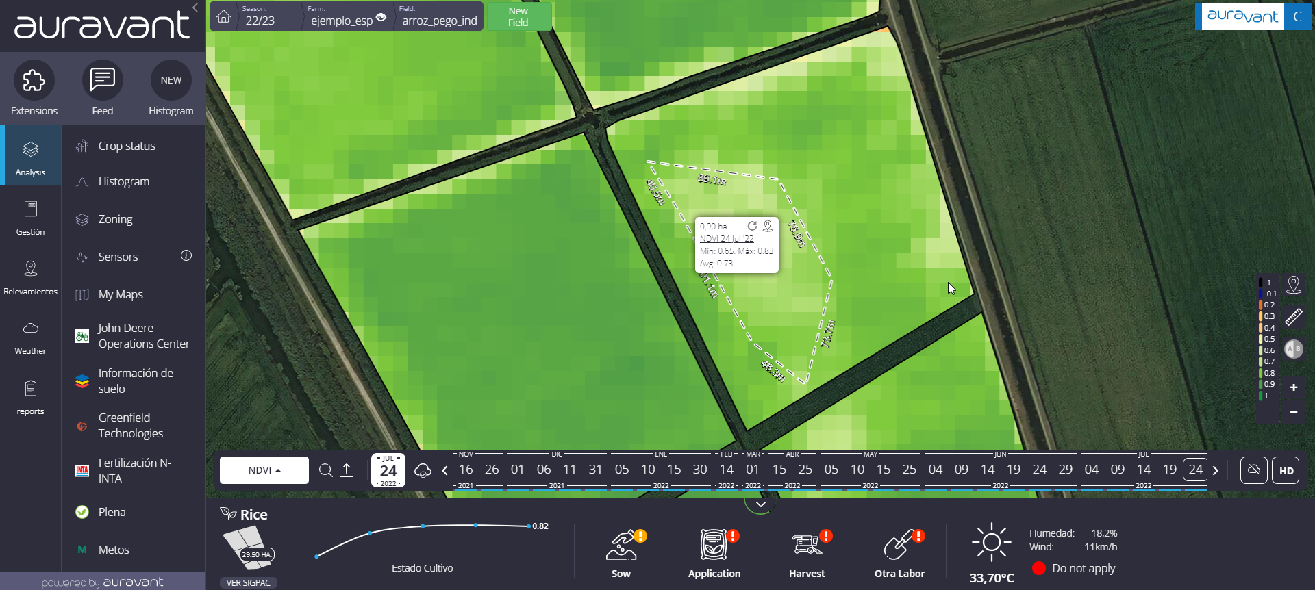
Surface area
Minimum and maximum values found in the previously selected layer.
Average value of the selected layer
This feature allows the evaluation of data per polygon to check, correct and improve future zonings and/or to compare differences between different crop varieties planted in the same field.
In case you have chosen a layer containing units with measurements in m2 or ha (e.g., Yield: Tn/ha) the total of the polygon/zonings will appear in the data.
Steps to follow to use the tool:
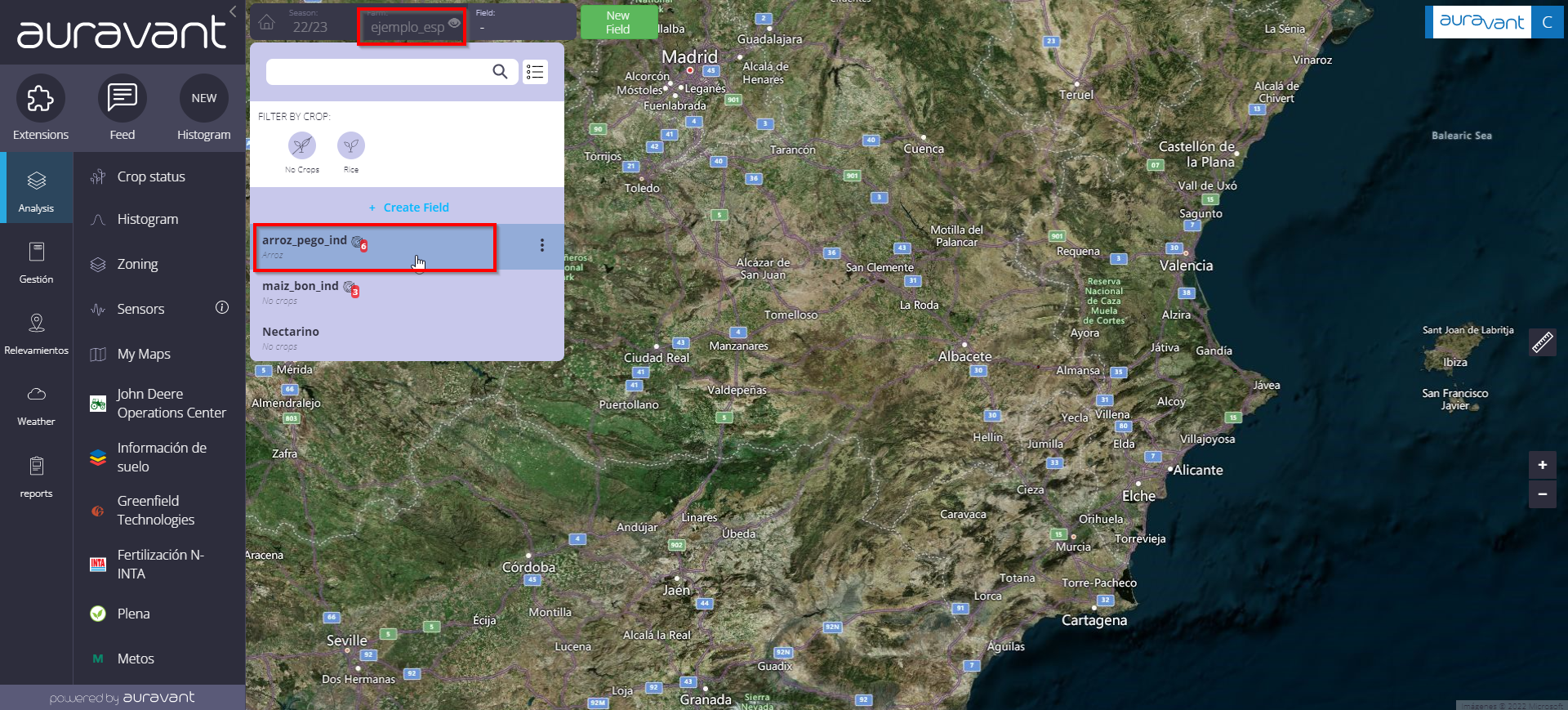
1- Select a field and choose an information layer (NDVI, GNDVI, yield map, etc.).

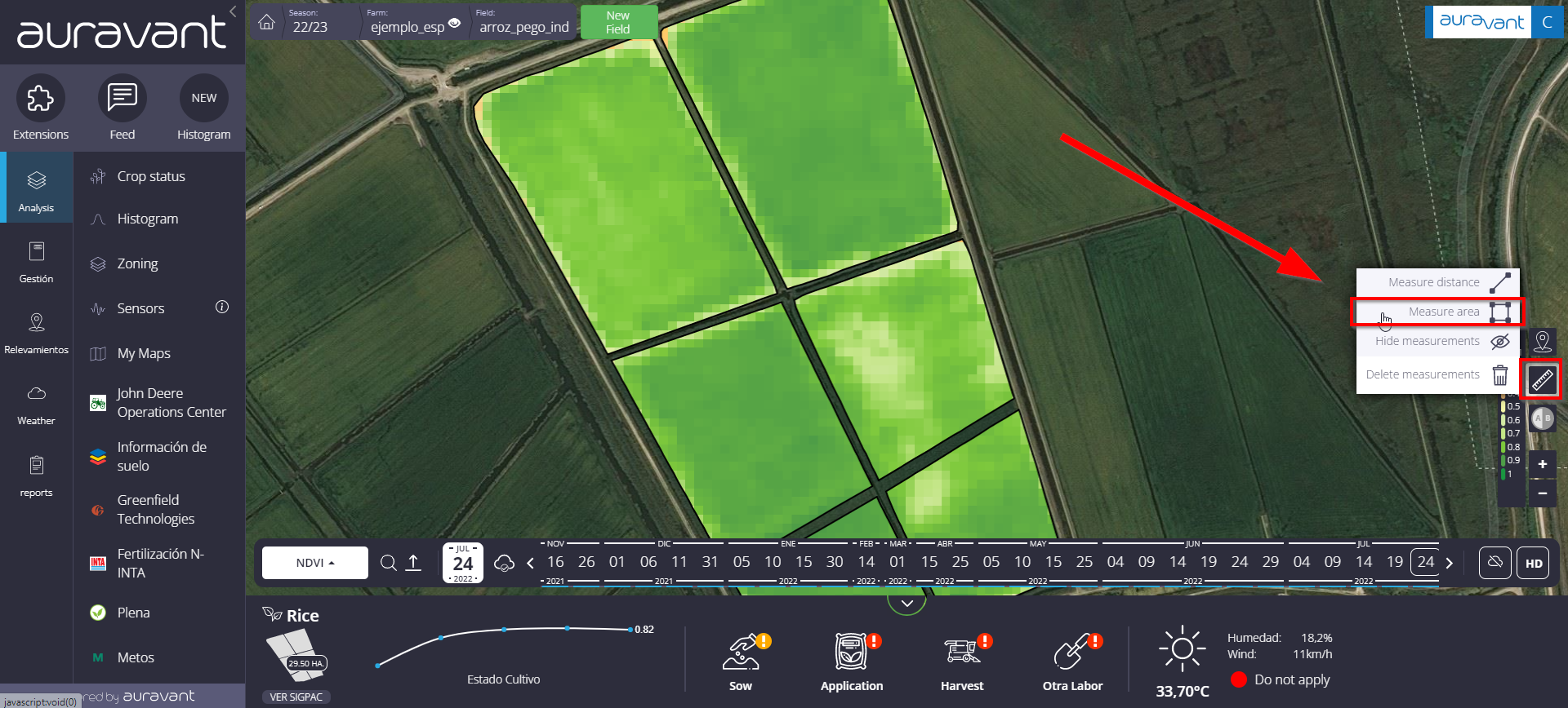
2- Click on the ruler symbol in the lower left margin and select the “Measure area” option.

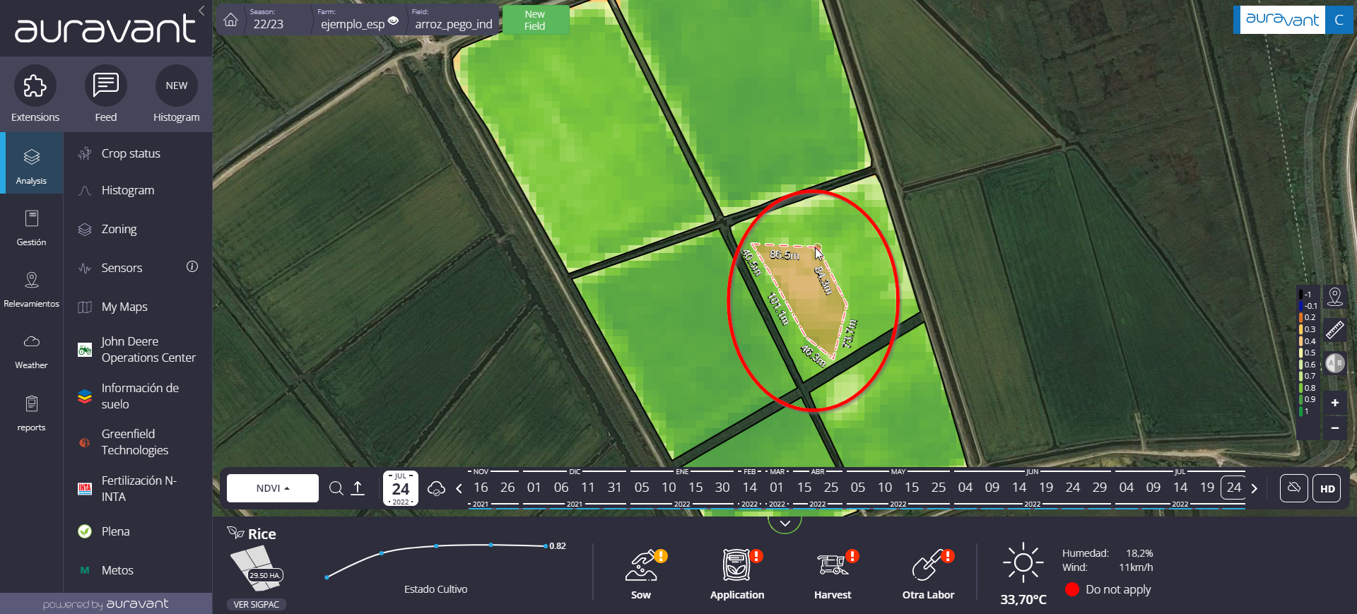
3- Draw the area on the field you want to obtain information about.

4- A table showing the processed information about the drawn area will open.

*In case you have a premium plan, you will have the option to generate a geolocalized marker on the drawn area, where you can save the information obtained and take it to the farm.
“
